Category Archives: Paleoclimate

New ideas in science can take ages to be understood and accepted

When recently participating in the jury process for the assessment of a student’s PhD thesis on palaeoweathering and surficial albitization in Spain (see previous article; https://bit.ly/2MmRMDZ), I summarized the difficulties faced by me and my students over many years in getting our observations and interpretations published and eventually (though perhaps reluctantly) accepted by the geological community in Europe .  This story began almost 50 years ago when my detailed studies of albitization in surficial landscapes across France and elsewhere in western Europe commenced.  The alteration had long been recognized but never seriously investigated.  My story begins:

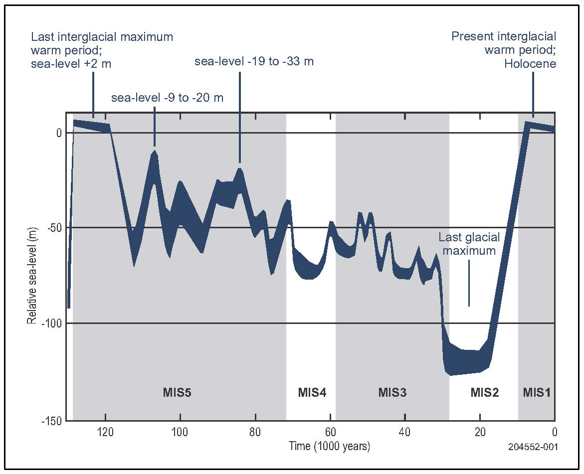
“During 1976-79 J-J Yerle completed a PhD on uranium deposits hosted in Permo-Carboniferous sediments in Rouergue (SW Massif Central).  It included studies of core from numerous drillholes and was accompanied by extensive mineralogical analyses using X-ray diffraction.  The major results were as follows: a fine-grained facies containing ~90% albite with no quartz or K-feldspar was encountered in the core; it appeared to have developed by albitization accompanied by chloritisation of biotite, but the intensity of the alteration decreased with depth and eventually disappeared.  Dr Yerle initially considered a syn-sedimentary model for the albitization but K-Ar dating pointed to a Triassic age which suggested a palaeoweathering model post-dating sedimentation.  None of our colleagues could accept this interpretation:  five days before the formal defence of Dr Yerle’s thesis one colleague entreated the Institute Director to cancel the proceedings.

“From 1978-86 Dr J-M Schmitt was employed by the Ecole des Mines de Paris and commenced a doctorat es Sciences thesis on a uranium mine hosted in a gneiss in northern Rouergue focussing on albitization.  He was able to demonstrate a clear decrease in the abundance of albite with depth in the profile; the geopetalcharacteristics of the profile, particularly its termination at depth where alteration was restricted only to fractures; and radiochronological data defining a Triassic age for the alteration.  However, even this scholarly work did not convince colleagues and associates.  On the contrary, many petrographers were opposed to the interpretation on the basis that they ‘knew’ that albitization could develop only at depth and at high temperatures – albite ‘could not’ form at low temperatures.

“During 1982-86 J-Y Clément undertook another PhD thesis on uranium deposits hosted in the Permian Lodève Basin, South of Rouergue.  Here, the host sediments are clastics with interstratified ash layers.  The base of the sequence is dark coloured and greenish; the top is red.  This colour change had been thought of as an original facies character of the sequence.  Dr Clément carefully described a profile consisting of an uppermost clay-enriched zone, an underlying zone in which the only feldspar present was pure albite (together with analcime); and a deeper zone containing secondary albite + Kfeldspar.  The alteration did not persist at depth.  All alteration horizons were discordant with the stratigraphy and were preserved under a Triassic sedimentary cover, which led to them being attributed to an infra-Triassic age.  Dr Clement correlated this profile and the accompanying alteration with Dr Schmitt’s Rouergue albitization, the latter occurring on the continental surface upstream of the basin where weathering had persisted after the deposition of the early Trias in the basin.  Yet, these observations and results were not convincing for many of our geologist colleagues.

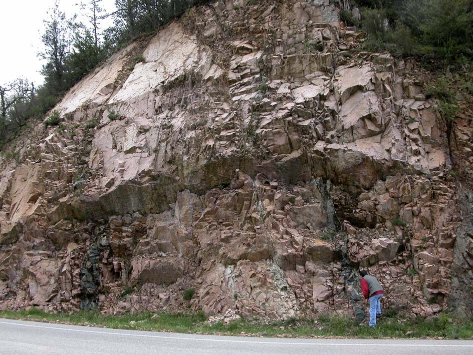
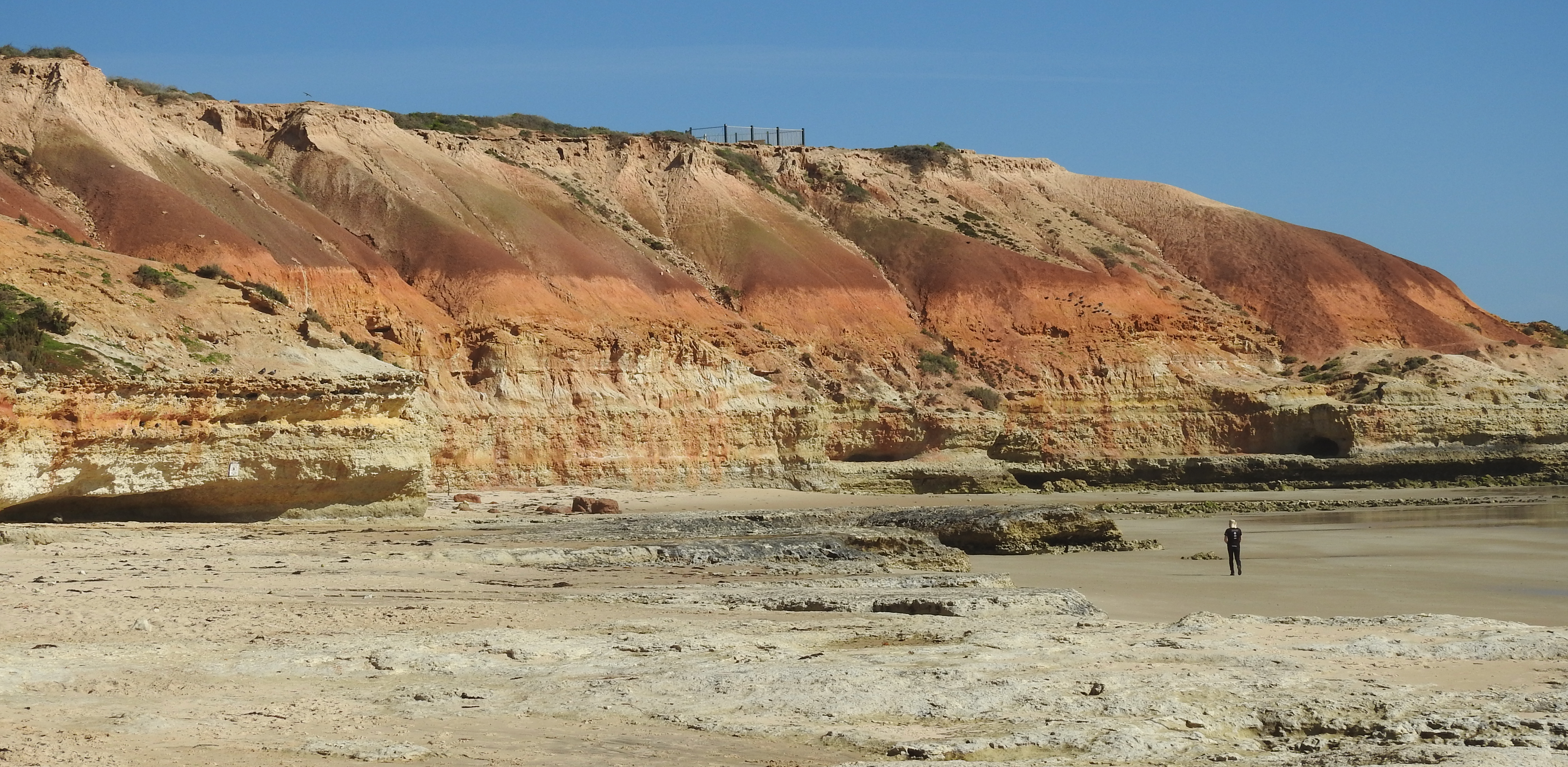
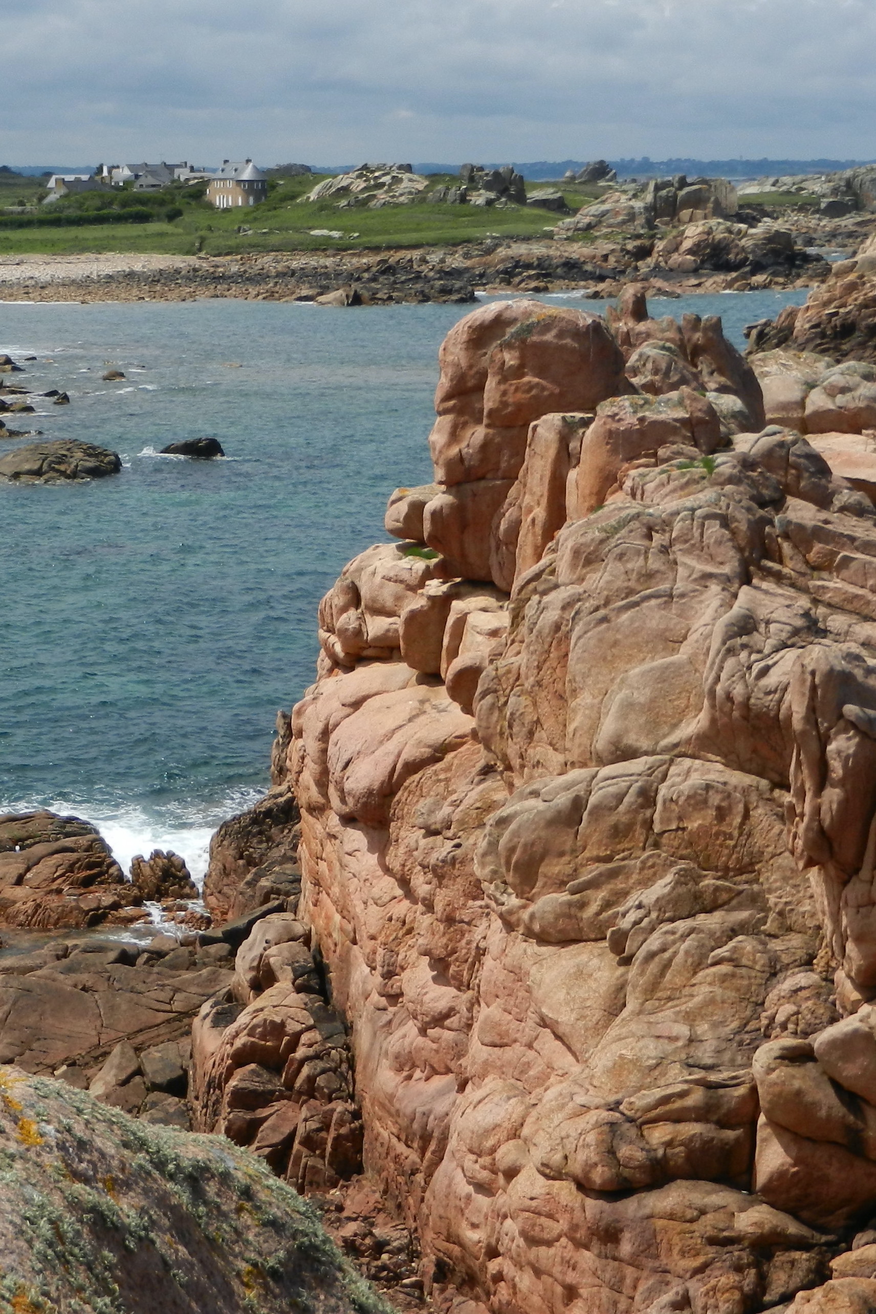
“During the period from 1986 until 2000, about 15 years, we did little further work on the albitization because of our critics: other angles of ‘attack’ on the alteration profiles had to be found.  One such approach came from numerous hikes in the Hercynian mountains and across Triassic palaeosurfaces.  A first clue came from a visit to the albitized Delamerian (Cambrian) granites on the southern coast of South Australia.  Then some traverses through the Morvan where the hilly terrain made it possible to better appreciate the widespread albitized profiles:  these are characterised by fresh, unaltered granites in valleys and pervasive red albitized facies on higher slopes and hilltops.  The same features were examined further north on the Brittany coast and the Vosges Massif, as well as in every part of the Massif Central, the Maures Massif on the French Riviera, at several places in the Alps, around Mont-Blanc, in Central the Spanish Massif and later in  Morocco.

Red albitised granites on the Brittany coast   

“1997 was the ‘tipping point’ when I went to Barcelona for field work on the Monjuic silification.  Dr David Gomez-Gras showed me the paleoweathering features below the Trias.  At each site I was more and more excited by the red facies thought to be the result of Triassic palaeoweathering:  associated with it were magnificent albitized profiles.  A plan was made to bring Dr David Parcerisa to Fontainebleau to undertake post-doctoral research on the Morvan.

“From 2000-2010, with Dr Parcerisa in Fontainebleau, there was a substantial renewal of energy in research on the Morvan albitized profiles.  The work included substantial field mapping and sampling and detailed petrographic studies supplemented by cathodoluminescence.  This gave a clear demonstration of a geopetal profile for the albitization.  But a paper we submitted for publication describing these observations and data was  rejected by a reviewer known as a specialist in albitization in sandstone reservoirs.  One particular dismissive comment from him was that ‘the authors have no experience in albitization and do not even know what albitization means’.  Unfortunately, this is an entrenched opinion offered by so-called peer reviewers on many papers with new ideas and interpretations submitted for publication nowadays. 

During the same period, I had a PhD student (Catherine Recordel) working on paleomagnetic dating of the Siderolithic palaeoweathering profiles on the Massif Central but we struggled to get results.  I suggested that she try to date the red albitized facies and this was successful and, eventually, so was the palaeomagnetic dating of the Siderolithic palaeoweathering profiles.  Dr Ricordel’s paper on the age of the Morvan profile was accepted and this turned out to be the pass for Dr Parcerisa to publish his paper on his petrographic studies!  One step forward – but yet some colleagues were still not convinced.  One petrologist who worked for 30 years on the episyénite albitized facies in the Massif Central told me that he didn’t believe in paleomagnetic dating!

“From 2005-2010 we continued with paleomagnetic dating.  Management in Mines-ParisTech Geoscience decided to promote research on the albitized profiles before I retired, for which I am grateful.  We started with post-doctoral research by Dr Christine Franke and later complemented it with a PhD study by Kouakou Yao.  Dr Yao’s research was focussed on the Sudetes Massif in Southern Poland.  Paleomagnetic dating was also undertaken in the Sudetes, Vosges and Catalonia Massifs.  All produced Triassic ages for the albitization . Extensive drilling in Norway, and additional drilling programs in the Maures Massif, generated very promising cores through albitized profiles.  Later, causal exploration showed albitized geopetal profiles in Ireland, Cornwall and Galicia.

“During the 2010s Dr Carles Fàbrega started research on his thesis and made a significant contribution by means of radiometric dating and isotope analyses of single minerals.  He confirmed the Triassic age for the albitic palaeoweathering profiles and also generated, for the first time, a temperature evaluation consistent with alteration in a palaeosurface or somewhat deeper regolith environment.  This has been a major additional cornerstone for the subject.

“In conclusion:  Max Plank said: A new truth in science never succeeds in triumphing by convincing its adversaries and bringing them to see the light, but rather because finally these adversaries die and a new generation grows, to whom this truth is familiar.’  There is the hope!

“This story evolved over 45 years and there are some lessons about research that extend from it.

  • First you need a basis in field studies to apply your ideas: without fieldwork ideas remain dreams in geology and there are no new ideas.  Observations in the field dictate what is possible (or not) and provides new facts.
  • You never can predict where or when new ideas will arise, and what they might be.  Progress in research is always due to opportunities, field opportunities, meeting with people with different experiences, and opportunities to insert an idea into another’s research program.  Opportunities must be taken as theyarise.
  • The essence of research is not to find out what others have already shown, but to innovate and to follow different pathways: from this springs the excitement of a quest for the unknown.
  • Finally, there is always risk-taking.  This is one difficulty of the multiple research programs that abound at present.  These research programs all aim to guide researchers and limit risk (mostly financial risk, of course) and so they tend to deviate as little as possible from what is already known.  It is a brave agency who will award funds to those who are either little-known or whose proposal does not conform to the orthodoxy.  This approach does not lead to novelty.  It curbs imagination and creativity. 
  • Research is like an unique artwork, a painting or a poem, and it should embody a quest for understanding and a captivating story.

(See also preceding companion article)

Dr Medard Thiry, December 2020

Surficial albitization – palaeoweathering preserved beneath the extensive Triassic unconformity in Western Europe

One form of albitization consists of the replacement (albitization) of Ca-bearing plagioclase by secondary Na-plagioclase (i.e. albite) and is typically accompanied by alteration of biotite to chlorite and the staining of the rock by iron oxide pigments.  In crystalline rocks, albitization is rather widespread but is traditionally considered result from deep and high-temperature metasomatic alteration linked to magma cooling during exhumation.  Studies of albitization have principally been undertaken by petrologists who are mostly interested in the origin and emplacement of granites and naturally focus on aspects of their petrography and the details of their parageneses in this context.  They interpret albitization to be a ‘window’ to post magmatic processes. 

But albitization can also be a consequence of surficial weathering.  The example we studied in Spain (Fig. 1) is widespread and spatially and temporally associated with a Triassic palaeosurface.  Its occurrence forces a completely different point of view about this form of alteration.  A major gap separates the two points of view about albitization and our findings have exposed a ‘cultural barrier’ that has to be breached in order to advance knowledge about this process, particularly where it is found in crystalline rocks.  Key foci in the scientific exchange ought to include the geometry of the alteration in the field, petrographic observations detailing stages in the alteration, and the dating of these stages.

Figure 1. Field locations of albitized granites below the Triassic unconformity in Spain. (a) Guilleries Massif. (b) Roc de Frausa Massif. CCR: Catalan Coastal Ranges. From Fabrega et al. (2019).
Figure 1. Field locations of albitized granites below the Triassic unconformity in Spain. (a) Guilleries Massif. (b) Roc de Frausa Massif. CCR: Catalan Coastal Ranges. From Fabrega et al. (2019).

The outcrop scale

The albitization we have studied in granites is characterised by reddening due to impregnation of the feldspars by iron oxides (Fig. 2).  It results in: (1) a pervasive coloration distributed rather homogeneously within the rock volume, (2) fracture-bound red to pinkish granite facies or (3) spotting when the alteration is weak, resulting in pinkish spots distributed within non-reddened rock.

Figure 2. Strongly albitized Variscan red granites below the Triassic unconformity in the Guilleries Massif, NE Spain.
Figure 2. Strongly albitized Variscan red granites below the Triassic unconformity in the Guilleries Massif, NE Spain.

In terms of structure, a vertical profile of albitized granite, with a typical thickness around 150-200 m, occurs below the Triassic unconformity in the Guilleries and Roc de Frausa Massifs in NE Spain (Fig. 3).  The most intense alteration occurs at the top, immediately below the unconformity, and progressively decreases in intensity with depth.  From the top to the bottom, the alteration facies change from red to pink and ultimately spotted.  Unaltered granites are found below (Fig. 3).

Figure 3. Vertical structure and facies evolution of the albitization profile. Intensity of alteration decreases with depth. (a) Mesozoic sedimentary cover. (b) Red facies. (c) Pink facies. (d) Spotted facies. After Parcerisa et al. (2010).

The microscope scale

Microscope observations of the albitized granites show a suite of reactions in the major minerals including plagioclase albitization, K-feldspar microclinization, biotite chloritization and quartz recrystallization.  Albitization affects the primary plagioclase, where the Ca-bearing cores of the crystals are pseudomorphosed by secondary albite along twin planes and micro-fractures (Fig. 4a, b).  Within this secondary albite, part of the calcium released during plagioclase replacement forms small patches of secondary calcite.  Primary K-feldspar crystals are partially pseudomorphosed by secondary microcline (Fig. 4a).  Biotite and is replaced by secondary chlorite (which contains large numbers of apatite inclusions compared with primary biotite; Fig. 4c), secondary titanite and anatase.  Clusters of rare-earth carbonate minerals, probably synchisite-Ce, can be seen inside the secondary porosity of albitized plagioclase and microclinized orthoclase in backscattered electron-microscope images (Fig. 4d).  Secondary quartz partially replaces primary quartz in the upper part of the profile (Fig. 4e).  Primary and secondary monazite occur at the reaction front between albitized and unaltered granite (Fig. 4f).

Figure 4. Cathodoluminescence and SEM images of albitized granite. Ab1: Primary plagioclase. Ab2: Secondary albite. Ap: Apatite. Cal2: Secondary calcite. Chl2: Secondary chlorite. Kfs1: Primary K-feldspar. Kfs2: Microclinized K-feldspar. Mnz1: Primary monazite. Mnz2: Secondary monazite. Qtz1: Primary quartz. Qtz2: Secondary quartz. Syn2: Secondary Synchysite-(Ce). Tit2: Secondary titanite. From Fabrega et al. (2019).

Age dating

Dating of albitized profiles has been conducted at different sites through Europe using a variety of dating methods, including: (1) K-Ar dating of albite and K-feldspar (Bonhomme et al., 1980; Schmitt et al., 1984); (2) palaeomagnetism of Fe-oxides (Ricordel et al., 2007; Parcerisa et al., 2010; Thiry et al., 2011; Yao et al. 2011, Franke et al., 2011, Yao, 2013) and, most recently, (3) K-Ar microprobe dating of albite and K-feldspar and electron microprobe U-Th-Pb dating of monazite (Fabrega et al., 2019).  All have established that the albitization and associated alteration occurred during the Late Permian to Early Triassic, around 250 Ma, while the Variscan granites were exposed at the landsurface. 

Thus, the red-stained albitization relates specifically to the Triassic palaeosurface and was preserved beneath it by a Mesozoic and Cenozoic sediment cover.  The alteration profiles are palaeoweathering features relating to surficial weathering and were nor much eroded.  The  geopetal organization (decreasing intensity of albitization with depth ending in alteration confined to fractures) is characteristic of weathering and alteration under the influence of geomorphology, climate, and groundwater.

Palaeoenvironmental setting of the alteration

The morphology of the alteration profile and its proximity to the Permo-Triassic palaeosurface suggests that the responsible fluids were Na-rich groundwaters (Fig. 5a).  The depth of the alteration profile, the long-lasting tectonic stability in the region, and the continental scale abundance of saline environments in the Permo-Triassic period were probably key factors in the development of this near-surface weathering event across Europe.  The albitization profiles remained preserved below the Triassic sedimentary cover or, in some cases (Fig. 5b), directly at the surface.  In contrast to the non-albitized granites usually decompose to sandy material when exposed to surface conditions, the albitized granite has an increased resistance to weathering and erosion.

Figure 5. Permo-Triassic setting that facilitated the development (a) and preservation (b) of albitization. From Fabrega et al. (2019.

Extent of the Late Permian to Early Triassic palaeoweathering

Thus far, this form of palaeoweathering has been observed in Morocco, the Catalan Coastal Ranges, Eastern Pyrenees, Galicia and La Mancha in Spain; Corsica, the Maures, French Central Massif (Fig. 6), Morvan, the Alps, the Vosges and Brittany in France; in Germany; Great-Britain and Ireland; Sudetes in Poland; and in the Oslo Fiord in Norway.

Summary

We have demonstrated that the albitized facies are of surficial origin and bound to the weathering (geochemical) environment linked to the Triassic palaeosurface.  This dramatically changes ideas about the geomorphic evolution of the basement areas over a large part of western Europe and is a major contribution to the geodynamic modeling of the region.Indeed, reconstruction of palaeosurfaces is a unique tool in unravelling the evolution of ancient continents.  Extending age data from the better-known sedimentary basin deposits to adjacent crystalline basement landscapes (particularly of palaeoweathering features) provides the possibility to set the correct framework for geodynamical models (Fig. 6).

Figure 6. Occurrence of dated palaeoweathering profiles on the French Massif Central crystalline basement. After Thiry et al. (2012).

References

  • Bonhomme, M., Yerle, J.-J., Thiry, M., 1980. Datation K-Ar de fractions fines associées aux minéralisations. Le cas du bassin uranifère permo-houiller de Brousse-Broquiès (Aveyron, France).- C.R. Acad. Sc., Paris, 291, sér. D, p. 121-123.
  • Fàbrega, C., Parcerisa, D., Thiry, M., Franke, M., Gurenko, A., Gòmez-Gras, D., Solé, J., Travé, A., 2019. Permian–Triassic red‑stained albitized profles in the granitic basement of NE Spain: evidence for deep alteration related to the Triassic palaeosurface. International Journal of Earth Sciences, https://doi.org/10.1007/s00531-019-01764-0.
  • Franke, C., Yao, K.F.E., Thiry, M., Gomez-Gras, D., Ihlen, P., Kadzialko-Hofmokl, M., Jelenska, M., Parcerisa, D., Fabrega, C., Lagroix, F., Turniak, C., Szuskiewicez, A., 2011. Réstitution de la paléosurface triasique par datation des ré-aimantations inscrites dans les massifs paléozoïques européens. 13ème Congrès français de Sédimentologie, Dijon, Publ. ASF, Paris, 68, p. 137.
  • Parcerisa, D., Casas, L., Franke, F., Gómez-Gras, D, Lacasa, G., Nunez, J.A., Thiry, M., 2010. Geomorphological stability of Permo-Triasic albitized profiles – Case study of the Montseny-Guilleries High (NE Iberia). Geophysical Research Abstracts, 12, EGU2010, EGU General Assembly 2010, 2 p.
  • Parcerisa D, Thiry M, Schmitt JM (2010b) Albitization related to the Triassic unconformity in igneous rocks of the Morvan Massif (France). Int J Earth Sci 99:527–544. doi: 10.1007/s00531-008-0405-1.
  • Ricordel, C., Parcerisa, D., Thiry, M., Moreau, M.‑G., Gómez-Gras, D., 2007. Triassic magnetic overprints related to albitization in granites from the Morvan massif (France). Palaeogeography, Palaeoclimatology, Palaeoecology, 251, p. 268-282, doi:10.1016/j.palaeo.2007.04.001.
  • Schmitt, J.-M., Baubron, J.-C., Bonhomme, M.-G., 1984. Pétrographie et Datations K-Ar des Transformations Minérales Affectant le Gîte Uranifère de Bertholène (Aveyron—France). Mineralium Deposita, 19(2), 123-131.
  • Thiry, M., Franke, C., Vercruysse, C., Kissel, C., Edel, J.-B., Bruhlet, J., 2011. Datation des paléoaltérations du massif cristallin des Vosges : implications pour l’évolution géodynamique du massif. 13ème Congrès français de Sédimentologie, Dijon, Publ. ASF, Paris, 68, p. 318
  • Thiry, M., Ricordel-Prognon, C., Franke, C., Brulhet, J., 2012. Modernité des paléosurfaces : leur rapport à la géodynamique. in : Cojan I., Grosheny D., Parize O. (eds) Expression de l’innovation en géosciences, Une journée avec Bernard Beaudoin, Paris, Presses des Mines, Collection Sciences de la Terre et de l’Environnement, p. 113-125.
  • Yao, K.F.E., 2013. Albitization and oxidation of the granitoïd rocks related to the Triassic paleosurface in the Sudetes (SW Poland). Thesis École Nationale Supérieure des Mines de Paris in Paris (France) and Państwowy Instytut Geologiczny – Państwowy Instytut Badawczy in Warsaw (Poland). 164 p. http://pastel.archives-ouvertes.fr/pastel-00971314.
  • Yao, K.F.E ., Franke, C., Thiry, M., Aleksandrowski, P., Szuszkiewicz, A., Turniak, K., 2011. Albitization as record of the Triassic Paleosurface in the Sudetic Crystalline basement (Poland). Geophysical Research Abstracts, 13, EGU 2011, EGU General Assembly 2011, Vienna, Austria, Geophysical Research Abstracts, Vol. 13, EGU2011-5930.

See also the companion article following (https://bit.ly/3puuvPk )

Dr Carles Fàbrega (Departament d’Enginyeria Minera, Industrial i TIC, Escola
Politècnica Superior d’Enginyeria de Manresa, Spain)

Gulf St Vincent & Adelaide beaches

Over the last million years in southern Australia, sea levels have fluctuated between about 120m below present sea level, during the Ice Ages, to about 2m above during the interglacials.  As humans first arrived in Australia more than 50,000 years ago, the sea level fluctuated between 60 and 40m below present, and vast coastal areas were exposed for settlement.  Gulf St Vincent has a maximum depth of 40m so, during those times, it had the form of a flat landscape of alluvial plains veneered with calcrete and covered by thin sandy soils and sporadic desert dunes gently sloping towards a central oblong saline swamp (Fig. 1).

Around 30,000 years ago the Earth plunged into a severe Ice Age that lasted until about 15,000 years ago, with sea levels dropping to 120m below present.  A warming climate then caused rising sea levels, so that by around 9,700 years ago the sea encroached into the land to form the Gulf (Fig. 2).  Continued climate warming and further sea level rise progressively filled the Gulf.  The warm shallow seas enabled prolific growth of algae and marine grasses that were nurseries to a rich ecology of fish, shellfish, starfish, sponges, calcareous algae and some corals.  Sand-sized foraminifera were abundant, especially in the nearshore and intertidal zones (corresponding to the mangrove-rich areas north of Adelaide).

By around 6,500 years ago the sea had reached its present level and the Gulf achieved its current shape.  Abundant shells and shell grit were deposited to form a meter-thick veneer of calcareous sediment covering the now drowned landscape.  Predominant south-southwesterly winds created waves that eroded these sediments, for example around Port Norlunga and Maslins Beach, and quartz sand winnowed from them mixed together with more recent shell grit to create the modern beaches (Figs 3, 4).  Some quartz sands came from more ancient deposits that are now exposed at Hallett Cove.

Frequent southwesterly storms drove coastal sands northward from Marino Rocks and Glenelg to form a coastal dune series that enclosed the Patawalunga and Westlake depression.  This wave-dominant dune system continued to grow northward creating the present Le Fevre Peninsula where around 10m of sand has accumulated (Fig. 5).

European settlement since 1836 has altered the coastal zone by building on or removing most sand dunes, thus allowing storms to attack roads and residences. Placement of rocky rip-rap with the aim of protecting the shoreline has in fact increased wave turbulence and lowered the beach profile by removing additional sand.  Replenishment of beach sands to maintain amenity is a continuing Government-funded activity.  Tennyson Dunes is one of a few tiny remnants that provide a glimpse of the original Adelaide metropolitan coastline.

References

Bourman RP, Murray-Wallace CV, Harvey N. 2016. Coastal Landscapes of South Australia.Available as a free ebook from www.adelaide.edu.au/press.

Fuller MK, Gostin VA. 2008. Recent coarse biogenic sediments of Gulf St Vincent.InSA Shepherd et al. (eds) Natural History of Gulf St Vincent.  Ch.3 , 29-37. (Royal Society of South Australia).

Harvey N, Belperio AP, Bourman RP. 2001.  Late Quaternary sea-levels, climate change and South Australian coastal geology.  InV Gostin (ed.) Gondwana to Greenhouse: Australian Environmental Geoscience. Geol. Soc. Aust. Spec. Publ. 21, 201-213.  (Geological Society of Australia: Sydney).

James NP, Bone Y. 2011. Neritic Carbonate Sediments in a Temperate Realm, (Springer Science+Business Media).

www.tennyson.org.au

Author: Dr VA Gostin

Paradigms in astronomy & Earth history are not absolute

Not a week passes that a new astronomical discovery is announced in the popular as well as the scientific press.  Our vision and appreciation of our living and cosmic environment is continually changing.  Old, long-held views – for example, that our solar system is the only example of planetary systems – continue to be replaced by new ideas and concepts.  During the 1960s and 1970s, we witnessed a similar paradigm shift from the notion of a very solid, relatively stable Earth, on which oceans and continents would periodically subside or emerge from beneath sea-level, to a vigorous Plate-Tectonic Earth, on which oceans are continually created and removed.  We now know that light and buoyant continents are essentially carried as ‘passengers’ on the ever-circulating, dense, underlying mantle.  It took decades before most (but not all) earth scientists were convinced by the evidence for this concept.

New astronomical techniques

Recent astronomical discoveries that challenge former theories are particularly fascinating.  Looking out into the far reaches of our Universe, researchers have now detected a radio signal from the first stars formed.  Because such distant red-shift signals fall in the FM radio electromagnetic spectrum, Judd Bowman, of the Arizona State University’s discovery team, had to use the Murchison Radio-astronomy Observatory in the ultra-quiet region of Western Australia, to detect the weak signal.  This discovery, as indeed most astronomical information, comes to us via exploration of the whole electromagnetic spectrum.

In contrast, a whole new way of exploring the universe by observing gravitational waves (first reported in April 2016) has recently been proved.  Andrew Grant has called this the beginning of multi-messenger astronomy (Physics Today, October 2017).  Seconds after the gravity wave recorders (LIGO and VIRGO) detected gravitational waves, the Fermi Gamma-Ray Space Telescope spotted a gamma-ray burst.  Many observatoriesconfirmed this event. The observations suggest that gamma-ray bursts result from colliding ultra-dense neutron stars, the enormous energy release from which is sufficient to create heavy elements like gold and uranium via the fusion of lighter elements.

Colliding-galaxies

This stunning image, taken by the Hubble Space Telescope, shows the individual galaxies UGC 1810 (right) and UGC 1813 (left) in the process of colliding. Together, this pair of interacting galaxies is known as Arp273. Image courtesy of NASA/ESA/HHT

In the past year, there have also been breakthroughs in the study of cosmic rays that continually bombard the earth.  While most are light protons, some are ultra-high energy cosmic rays made of iron nucleii that may originate from supermassive black holes in the centre of distant galaxies.  In addition to cosmic rays, our planet is immersed in charged particles emanating from the Sun in what is termed the solar wind.  This reacts with the Earth’s magnetic field and creates numerous transitory phenomena including the aurorae, sprites and lightning.  The solar wind controls spaceweather and climate.  On the other hand, retention of the Earth’s atmosphere is generally attributed to theplanet’s strong magnetic field which prevents widespread stripping of the volatile gasses by the solar wind.  A review of the Earth’s electromagnetic environment was published by Catherine Constable in 2016 (Surveys in Geophysics37, p27-45).

When some massive stars are at the end of their life cycle they become supernovae that violently explode, expelling gas at high speed into space.  These explosions are strong enough to hurl matter across vast distances into neighbouring galaxies.  Our own Milky Way galaxy has apparently grown significantly by capturing material from its satellite galaxies, namely the Small and Large Magellanic Clouds (A. Woodward, New Scientist, August 2017). We clearly live in a complex interactive universe, but the time scales are vast in comparison to the brevity of human experience.

Collapse of a single planetary paradigm

The old paradigm of planetary origins based on our Solar System has collapsed with the discovery of hundreds of other planets with very different orbits.  An article by Ann Finkbeiner (Planets in Chaos: Nature, July 2014) describes this astronomical puzzle.  Planets in their early years collided, interacted, migrated and grew in size, before ultimately settling into some relatively stable arrangement. This turbulent and chaotic impact history during the early assemblage of planets resulted in the expulsion of some planets into the cold emptiness of space, away from their parent stars.  Some stars, like our own Sun, have large families of planets.  As of December 2017, researchers have identified 3,567 exoplanets.  Two telescopes planned to be launched in 2018 will search for signs of other planets by observing their crossings in front of parent stars (J.N. Winn, Scientific American, March 2018, p26-33).

Meteors and impacts on Earth

Recent observations confirm that meteorite impact on Earth is a dynamic process that continues and directly influences our environment.  The planet is continually showered by meteors of various sizes from microscopic space dust and visible sand-sized meteorite grains, up to fragments, some kilometers in diameter, of rarer asteroids or comets.

Some asteroids with unusual fractured shapes and compositions have recently whizzed past our planet on hyperbolic (i.e. non-returning) orbits, and continued onto other stellar rendezvous (K. Cooper, New Scientist, February 2018).  The estimated number of such interstellar objects may be in the thousands.  More relevant of course, have been those visitors that have made direct hits on Earth. Much of Earth’s history since Proterozoic times has in fact been shaped by catastrophic meteorite impacts that have triggered mass extinctions of living creatures and other biological effects.  The immense impact some 63 million years ago that spelt the extinction of dinosaurs, as well as ammonites and other marine creatures, is well known, as perhaps is the atmospheric explosion at Tunguska, in central Siberia only a century ago (1908).  Recognition of the importance of major meteorite impacts on Earth history has been yet another paradigm shift in our understanding.

A cometary catastrophe

Less well known is the discovery that fragments of a disintegrating ~100km-diameter comet collided with the Earth some 12,800 years ago in what is known as the Younger Dryas period (named after a signature Arctic flower).  The collision triggered a rapid return to glacial conditions which lasted about 1,400 years, interrupting the gradual warming of the planet after the Last Glacial Maximum around 20,000 years ago.  In a two-part publication in 2018, Wendy Wolbach (and 31 co-authors) presented a detailed analysis of evidence of this most unusual climatic episode gathered over the last decade (W.S. Wolbach et al.,Journal of Geology126, p165-184 & p185-205).  Data was gathered from ice-cores in Greenland, Russia and Antarctica as well as from lake, marine and terrestrial sediments.  Contemporaneous layers of charcoal and dust in these geographically dispersed cores confirm this cosmic impact event.  These specific layers are enriched in platinum and other impact-related elements.  They also contain glassy spherules and nano-diamonds, and are anomalously high in ammonia, nitrate, and other compounds that represent a major period of extensive biomass burning.  Sea levels rose a few metres due to major melting of the North American Ice Cap and this surge of fresh water disturbed the oceanic circulation that began a period of cooling.

YDB field

YDB = Younger Dryas boundary field. graphic from C.R. Kinzie et al. The Journal of Geology, 2014, v122, p475–506.

Evidence points to numerous fragments of a disintegrating comet detonating above and/or colliding with ice-sheets, oceans, and land on at least four continents centred on North America.  The radiant and thermal energy from multiple explosions triggered extensive wildfires that are estimated to have burned about 10% of the planet’s biomass, considerably more than that accompanying the meteorite impact that caused the demise of the dinosaurs.  The burning created long-lived atmospheric soot, blocking most sunlight and creating an ‘impact winter’ and acid rain.  The reduced vegetation caused a major crisis in the ecosystem and may have contributed to many megafaunal extinctions including mammoths, mastodons, ground sloths and American horses, along with many birds and smaller mammals.  Human population declined for about a thousand years and the demise of the Clovis hunters ensued.  This synchronicity of multiple events makes the Younger Dryas interval one of the most unusual climatic/ecological episodes during the last two million years.  It also raises the importance of supporting the Near Earth Asteroid Survey in defence of future serious impacts on our planet.

Our changing paradigms

The rapid acquisition of new and exciting knowledge about astronomy and Earth history requires paradigm shifts in our thinking and interpretation.  We should always be prepared for new scientific observations and revelations and continue to adapt our ideas and concepts to better explain our cosmic and earthly environments.

Dr Vic Gostin

Fossil shells at Stansbury, South Australia, record a higher sealevel 125,000 years ago

Subsamples were taken of a collection of fossil shells recovered from a depth of around 3 m in trenches excavated in the Oyster Point Caravan Park by local contractors to improve drainage. Several of the fossils (Fig. 1) had been identified by SA Museum personnel and assigned to species including bivalves Katelysia scalarina and Sanguinolaria (Psammotellina) biradiata, and the large gastropod Turbo (Dinassovica) jourdani. All species are still living around the Australian coast, but these shells are clearly ancient and belong to a time when the coastal cliffs at Stansbury stood inland of the caravan park and the township and are now represented by the base of the hill that runs from the cemetery, northwards behind the town centre, and joins the current shore cliffs near the primary school oval. The seas, of which the fossil shells are a legacy, covered all of the lowland eastwards of these ancient cliffs. The cliffs themselves are in fact cut into much older marine deposits, as can be seen behind the jetty and elsewhere along the coast. These relate to the Tertiary period between 3 to 23 million years ago when much of Yorke Peninsula was inundated by sea.

Shell subsamples of two of the species (Katelysia scalarina and Sanguinolaria (Psammotellina) biradiata) were dated in the laboratories of the School of Earth & Environmental Sciences at the University of Wollongong by Professor Colin Murray-Wallace and his colleagues. They used a technique called Amino Acid Racemisation (AAR) and found that the shells are about 125,000 years old. Professor Murray-Wallace can be confident of this dating because he and his colleagues have much experience in determining the ages of ancient Quaternary coastlines of southern Australia and their fossils (see Further reading).

Sea levels 125,000 years ago (Fig. 2) were up to 2m above current sea level, as this time was part of an interglacial period (formally called the ‘Last Interglacial’) when ice in Antarctica and elsewhere had melted somewhat due to warmer global temperatures. This accounts for the encroachment of the seas into the embayment now occupied by much of Stansbury township, and the formation of the old cliff-line. The marine and coastal deposits generated at this time, and which occur widely around South Australian coasts, are referred to the Glanville Formation.

It might be of interest to note that several earth scientists, including Professor Murray-Wallace, have written a book on the coastal landscapes of South Australia. This is currently in press and should be available soon. It includes a chapter on the entire coast of Yorke Peninsula, including Stansbury. As well, a student from the School of Earth & Environmental Sciences at the University of Wollongong (Tsun-You Pan, visiting from Taiwan), and supervised by Professors Murray-Wallace and Bourman, has recently commenced a PhD research project on the Last Interglacial coasts and their deposits on southern Yorke Peninsula and may be able to report in future on his findings on these materials, including the Stansbury Caravan Park fossils.

Further reading

Bourman, R.P., Murray-Wallace, C.M. & Harvey, N. (2016, in press). Coastal Landscape of South Australia. University of Adelaide Press.

Ludbrook, N.H. (1984). Quaternary molluscs of South Australia. Handbook No. 9, 327pp. Department of Mines & Energy South Australia. (Government Printer: Adelaide).

Murray-Wallace, C.V., Bourman, R.P., Prescott, J.R., Williams, F, Price, D.M. & Belperio, A.P. (2010). Aminostratigraphy and thermoluminescence dating of coastal aeolianites and the later Quaternary history of a failed delta: The River Murray mouth region, South Australia. Quaternary Geochronology Vol. 5, pp28-49.

Zang, W-L, Cowley, W.M. & Fairclough, M. (2006). 1:250 000 Geological Series – Explanatory Notes. Maitland Special South Australia. Sheet S153-12 International Index. 62pp. Primary Industries and Resources SA (Government of South Australia).

Dr Tony Milnes, Earth Sciences, University of Adelaide

IMG_0272_cropped

Fig. 1 Assemblage of fossil shells found in excavation.

Fig 2

Fig. 2. Sea level curve for the past 130 000 years. Adapted from Lambeck and Chappell (2001). The thickness of the line of the curve is an expression of the degree of uncertainty of the calculated sea-levels. During the Last Glacial Maximum sea level was about 120 m lower than at present. The Last Interglacial warm period occurred about 130 000 to 120 000 years ago, when sea level was at least 2 m higher than at present. The present interglacial warm period (Stage 1) has existed for little more than the past 10 000 years. Source: Cann, J. (2014). Robe Geological trail. (Geological Society of Australia: South Australian Division).